The Histories of Mexico
Supplemental Info: Ep 13: Map of Colorado River Delta and Juan Bautista De Anza’s Trail
Colorado River Delta

Map of the Colorado River delta region showing approximates dates and locations of previous river courses. Areas outside the delta region are shown as a hillshade with lighter colors at higher elevations.
- Geomorphic change and sediment transport during a small artificial flood in a transformed post-dam delta: The Colorado River delta, United States and Mexico - Scientific Figure on ResearchGate. Available from: https://www.researchgate.net/figure/Map-of-the-Colorado-River-delta-region-showing-approximates-dates-and-locations-of_fig13_308133114 [accessed 5 May, 2023]
Juan Bautista De Anza Trail
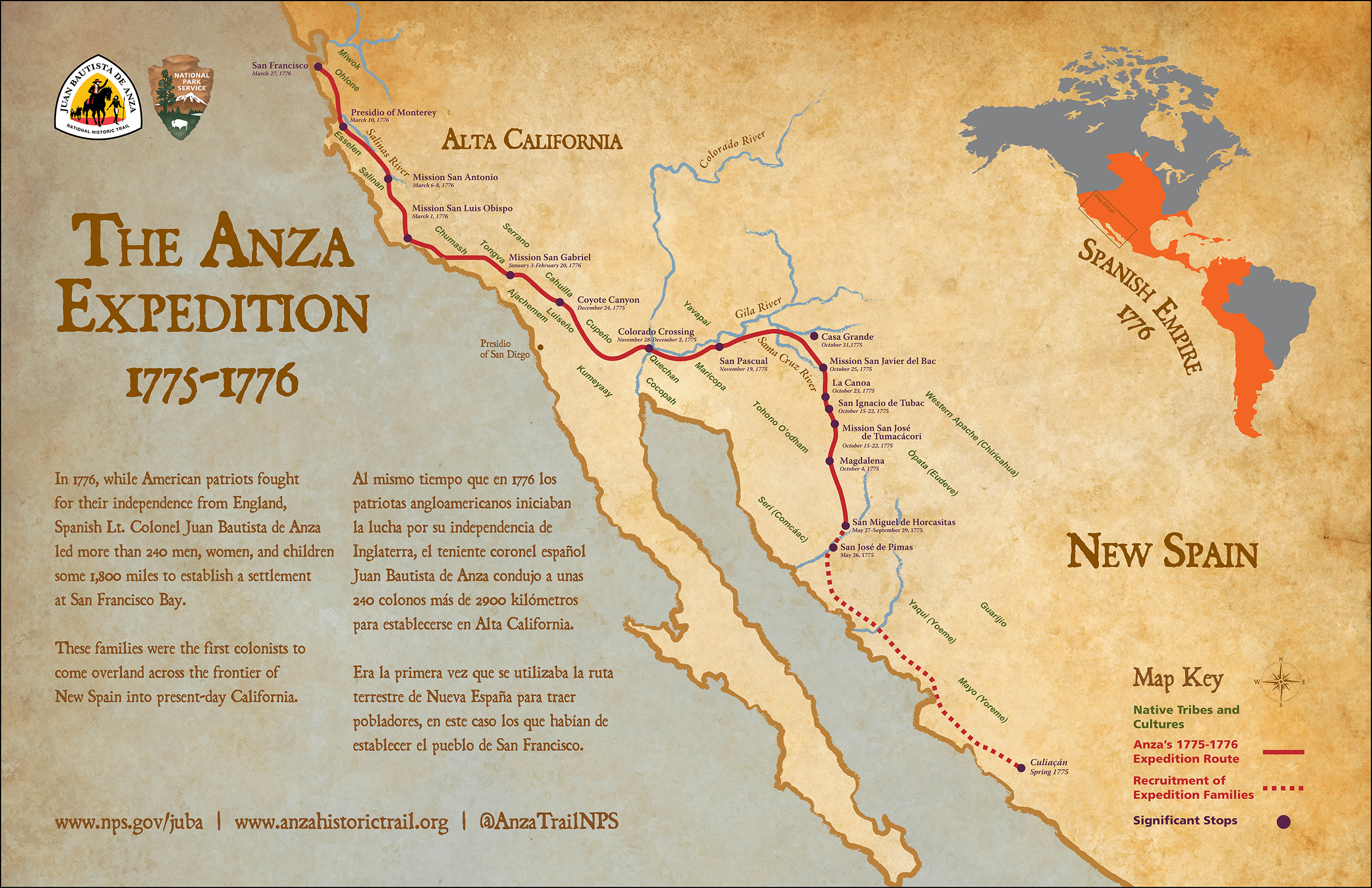
Map of the Anza Expedition 1775-1776.
- https://www.nps.gov/juba/planyourvisit/maps.htm